
Please note that the Maps show both the ‘included’ and ‘excluded’ streets.
Please note that some Major Street segments were excluded from the changes by Council. You will therefore need to consult the [Major Streets Excluded by Council] list when reviewing the maps.
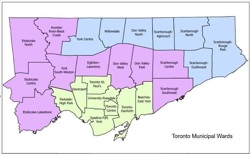
Find your ward
The maps below are organized by ward. Select your ward to view the Major Streets and the residentially zoned properties within that ward.
When reviewing the maps, look for properties shaded in yellow. The yellow shading identifies residentially zoned properties located on Major Streets that are subject to the new zoning changes.
Major Street Maps by Ward
- Ward 1 – Etobicoke North
- Ward 2 – Etobicoke Centre
- Ward 3 – Etobicoke – Lakeshore
- Ward 4 – Parkdale – High Park
- Ward 5 – York South – Weston
- Ward 6 – York Centre
- Ward 7 – Humber River – Black Creek
- Ward 8 – Eglinton – Lawrence
- Ward 9 – Davenport
- Ward 10 – Spadina – Fort York
- Ward 11 – University – Rosedale
- Ward 12 – Toronto – St. Paul’s
- Ward 13 – Toronto Centre
- Ward 14 – Toronto – Danforth
- Ward 15 – Don Valley West
- Ward 16 – Don Valley East
- Ward 17 – Don Valley North
- Ward 18 – Willowdale
- Ward 19 – Beaches – East York
- Ward 20 – Scarborough – Southwest
- Ward 21 – Scarborough Centre
- Ward 22 – Scarborough – Agincourt
- Ward 23 – Scarborough North
- Ward 24 – Scarborough – Guildwood
- Ward 25 – Scarborough – Rouge Park